| Route |
Name |
Southern/Western
Terminus |
Northern/Eastern
Terminus |
Length |
Notes |
 |
Swart Hill Rd. |
 |
Schenectady County Line
(Schenectady CR 40) |
1.95 miles
(3.14 km) |
|
 |
Cranes Hollow Rd. |
|
 |
3.47 miles
(5.59 km) |
|
 |
Antlers Rd. |
|
|
1.89 miles
(3.04 km) |
|
 |
Belfance Rd. |
Montgomery CR 5 |
|
0.00 miles
(0.00 km) |
|
 |
MacLachlan Rd. |
Montgomery CR 6 |
Montgomery CR 2 |
1.25 miles
(2.01 km) |
|
 |
Waterstreet Rd. |
Montgomery CR 7 |
Montgomery CR 5 |
0.71 miles
(1.14 km) |
|
 |
Truax Rd. |
|
|
1.94 miles
(3.12 km) |
|
 |
Widow Susan Rd. |
Montgomery CR 157 |
Amsterdam City Line
(Clizbe Ave.) |
1.55 miles
(2.50 km) |
|
 |
Mannys Corners Rd. |
|
Hagaman Village Line
(Church St.) |
1.25 miles
(2.01 km) |
|
 |
Jones Rd. |
Montgomery CR 9 |
|
1.86 miles
(2.99 km) |
|
 |
Hammondtown Rd. |
Hagaman Village Line
(Lansing St.) |
Montgomery CR 12 |
1.51 miles
(2.43 km) |
|
 |
Morrow Rd. |
|
Fulton County Line
(Morrow Rd.) |
1.17 miles
(1.88 km) |
|
 |
Northern Blvd. |
Amsterdam City Line
(Northern Blvd.) |
Hagaman Village Line
(Northern Blvd.) |
0.71 miles
(1.14 km) |
|
 |
Midline Rd. |
Amsterdam City Line
(Locust Ave.) |
Fulton County Line
(Midline Rd.) |
1.62 miles
(2.61 km) |
|
 |
Wallins Corners Rd. |
 |
Montgomery CR 14 |
0.86 miles
(1.38 km) |
|
 |
Log City Rd. |
McKay Rd. |
|
1.11 miles
(1.79 km) |
|
 |
Golf Course Rd. |
Montgomery CR 19 |
|
1.46 miles
(2.35 km) |
|
 |
Steadwell Rd. |
Amsterdam City Line
(Steadwell Ave.) |
Montgomery CR 20 |
1.05 miles
(1.69 km) |
|
 |
Lepper Rd. |
Fort Johnson Village Line
(Lepper Rd.) |
Fulton County Line
(Lepper Rd.) |
1.62 miles
(2.61 km) |
|
 |
Noonan Rd. |
Montgomery CR 38 |
Fulton County Line
(Noonan Rd.) |
0.95 miles
(1.53 km) |
|
 |
Sacandaga Rd. |
Montgomery CR 28 |
Fulton County Line
(Sacandaga Rd.) |
2.23 miles
(3.59 km) |
|
 |
Bendick Corners Rd. |
|
Fulton County Line
(Fulton CR 142) |
0.37 miles
(0.60 km) |
|
 |
Mohawk Dr. |
|
|
3.90 miles
(6.28 km) |
Part of original NY 5 alignment |
 |
Main St. |
 |
Montgomery CR 26 |
1.54 miles
(2.48 km) |
|
 |
Stoners Trail Rd. |
Montgomery CR 26 |
Fulton County Line
(Fulton CR 103) |
2.71 miles
(4.36 km) |
|
 |
Albany Bush Rd. |
Montgomery CR 30 |
|
2.74 miles
(4.41 km) |
|
 |
Old Trail Rd. |
 |
Montgomery CR 26 |
7.38 miles
(11.88 km) |
Discontinuous 0.09 miles at Montgomery CR 31 |
 |
Switzer Hill Rd. |
|
Fulton County Line
(Fulton CR 148) |
2.22 miles
(3.57 km) |
|
 |
Wemple Ave. |
|
 |
0.15 miles
(0.24 km) |
|
 |
Hickory Hill Rd. |
Nelliston Village Line
(Stone Arabia St.) |
|
11.98 miles
(19.29 km) |
|
 |
Stone Arabia Rd. |
|
Montgomery CR 35 |
11.15 miles
(17.95 km) |
|
 |
Martin Rd. |
|
|
1.61 miles
(2.59 km) |
|
 |
Persse Rd. |
|
Fulton County Line
(Fulton CR 116A) |
2.11 miles
(3.40 km) |
|
 |
Indian Rd. |
Montgomery CR 34 |
Fulton County Line
(Indian Rd.) |
2.96 miles
(4.77 km) |
|
 |
McDonald Rd. |
|
Montgomery CR 40 |
2.01 miles
(3.24 km) |
|
 |
Maple Ave. Ext. |
|
Hagaman Village Line
(Maple Ave.) |
1.20 miles
(1.93 km) |
|
 |
McKay Rd. |
Montgomery CR 18 |
Fulton County Line
(McKay Rd.) |
1.31 miles
(2.11 km) |
|
 |
Oswegatchie Rd. |
Montgomery CR 42 |
Montgomery CR 33 |
4.11 miles
(6.62 km) |
|
 |
McKinley Rd. |
|
Montgomery CR 43 |
3.54 miles
(5.70 km) |
|
 |
Dillenback Rd. |
 |
Montgomery CR 33 |
2.60 miles
(4.19 km) |
|
 |
Brower Rd. |
Montgomery CR 42 |
Montgomery CR 42 |
3.76 miles
(6.05 km) |
|
 |
Caswell Rd. |
Montgomery CR 42 |
Montgomery CR 43 |
1.63 miles
(2.62 km) |
|
 |
Groff Rd. |
|
|
1.70 miles
(2.74 km) |
|
 |
Nellis Rd. |
Montgomery CR 48 |
|
2.33 miles
(3.75 km) |
|
 |
Wagners Hollow Rd. |
|
|
2.92 miles
(4.70 km) |
|
 |
Old McKinley Rd. |
Montgomery CR 44 |
Montgomery CR 42 |
0.23 miles
(0.37 km) |
|
 |
Otsquago Club Rd. |
Fort Plain Village Line
(Otsquago Club Rd.) |
Dead End |
1.10 miles
(1.77 km) |
|
 |
S. St. Johnsville St. |
Montgomery CR 61 |
Dead End |
0.34 miles
(0.55 km) |
|
 |
New Tpke. |
|
|
0.33 miles
(0.53 km) |
|
 |
Burrell Rd. |
|
Fulton County Line
(Fulton CR 140) |
2.25 miles
(3.62 km) |
|
 |
Fox Rd. |
|
|
0.86 miles
(1.38 km) |
|
 |
Kringsbush Rd. |
St. Johnsville Village Line
(Averill St.) |
Fulton County Line
(Kringsbush Rd.) |
1.69 miles
(2.72 km) |
|
 |
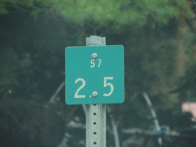
Lassellville Rd. |
Montgomery CR 57 |
Fulton County Line
(Fulton CR 114) |
1.17 miles
(1.88 km) |
|
 |
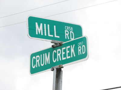
Crum Creek Rd. |
 |
St. Johnsville Village Line
(N. Division St.) |
3.16 miles
(5.09 km) |
|
 |
Mill Rd. |
|
Montgomery CR 57 |
1.60 miles
(2.58 km) |
|
 |
Clay Hill Rd. |
Montgomery CR 60 |
Kennedy Rd. |
2.62 miles
(4.22 km) |
|
 |
Old State Rd. |
Montgomery CR 59 |
|
0.30 miles
(0.48 km) |
|
 |
Bridge St. |
Montgomery CR 65 |
St. Johnsville Village Line
(Bridge St.) |
0.66 miles
(1.06 km) |
|
 |
Allen Heights Rd. |
Montgomery CR 57 |
Montgomery CR 57 |
0.40 miles
(0.64 km) |
|
 |
Mindenville Dr. |
Montgomery CR 65 |
Dead End |
1.03 miles
(0.00 km) |
|
 |
Fisk Hill Rd. |
 |
Montgomery CR 97
(Minden-Canajoharie Town Line) |
0.89 miles
(1.43 km) |
|
 |
Freedas Way
River Rd. |
Herkimer County Line
(Herkimer CR 188) |
|
7.54 miles
(12.14 km) |
|
 |
Sanders Rd. |
Montgomery CR 69 |
Montgomery CR 65 |
3.73 miles
(6.01 km) |
|
 |
Airport Rd. |
|
Montgomery CR 65 |
1.48 miles
(2.38 km) |
|
 |
Paris Rd. |
Montgomery CR 70 |
|
3.68 miles
(5.92 km) |
|
 |
Pickle Hill Rd. |
 |
Fort Plain Village Line
(Main St.) |
3.18 miles
(5.12 km) |
|
 |
Fordsbush Rd. |
|
|
4.40 miles
(7.08 km) |
|
 |
Phillip Rd. |
Herkimer County Line
(Herkimer CR 82) |
|
1.36 miles
(2.19 km) |
|
 |
Lighthall Rd. |
Herkimer County Line
(Herkimer CR 206) |
|
0.92 miles
(1.48 km) |
|
 |
Brookmans Corners Rd. |
Montgomery CR 76 |
|
4.32 miles
(6.96 km) |
|
 |
Hessville Rd. |
Montgomery CR 73 |
|
3.30 miles
(5.31 km) |
|
 |
Salt Springville Rd. |
Montgomery CR 80 |
Montgomery CR 73 |
4.32 miles
(6.96 km) |
|
 |
Starkville Rd. |
Herkimer County Line
(Herkimer CR 74) |
Montgomery CR 77 |
0.00 miles
(0.00 km) |
|
 |
Indian Trail Rd. |
Montgomery CR 80 |
|
2.48 miles
(3.99 km) |
|
 |
Ripple Rd. |
Montgomery CR 80 |
Otsego County Line
(Otsego CR 32A) |
0.48 miles
(0.77 km) |
|
 |
Freybush Rd. |
Montgomery CR 73 |
|
2.90 miles
(4.67 km) |
|
 |
Clinton Rd. |
Otsego County Line
(Otsego CR 31) |
Canajoharie Village Line
(Ridge Rd.) |
9.80 miles
(15.78 km) |
|
 |
Van Deusenville Rd. |
Otsego County Line
(Otsego CR 32B) |
|
1.01 miles
(1.63 km) |
|
 |
Cherry Valley Rd. |
Otsego County Line
(Otsego CR 32) |
|
0.73 miles
(1.18 km) |
|
 |
Dugway Rd. |
Otsego County Line
(Otsego CR 32A) |
Montgomery CR 82 |
0.96 miles
(1.55 km) |
|
 |
Buel Rd. |
|
Montgomery CR 80 |
1.58 miles
(2.54 km) |
|
 |
Dygert Rd. |
Montgomery CR 80 |
Montgomery CR 86 |
2.33 miles
(3.75 km) |
|
 |
Marshville Rd. |
|
|
3.52 miles
(5.67 km) |
|
 |
Seebers Ln. |
Montgomery CR 80 |
Canajoharie Village Line
(Smith St.) |
1.93 miles
(3.11 km) |
|
 |
W. Ames Rd. |
|
|
2.41 miles
(3.88 km) |
|
 |
Latimer Hill Rd. |
|
Montgomery CR 102 |
5.82 miles
(9.37 km) |
|
 |
Maple Hill Rd. |
Montgomery CR 94 |
Montgomery CR 94 |
2.43 miles
(3.91 km) |
|
 |
Blaine Rd. |
Montgomery CR 92 |
Montgomery CR 93 |
2.80 miles
(4.51 km) |
Part of NY 363 (1930-31) and NY 361 (1931-35) former alignments |
 |
Mapletown Rd. |
|
Montgomery CR 93 |
5.63 miles
(9.06 km) |
|
 |
Carlisle Rd. |
Canajoharie Village Line
(Maple Ave.) |
Montgomery CR 104 |
12.35 miles
(19.88 km) |
Part of NY 363 (1930-31), NY 361 (1931-35), and NY 394 (1930-35) former alignments |
 |
Old Sharon Rd. |
|
Montgomery CR 93 |
4.87 miles
(7.84 km) |
|
 |
Hilltop Rd. |
Montgomery CR 93 |
 |
2.52 miles
(4.06 km) |
Part of NY 394 (1930-35) former alignment |
 |
Heiser Rd. |
Montgomery CR 80 |
Montgomery CR 64
(Minden-Canajoharie Town Line) |
1.14 miles
(1.84 km) |
|
 |
Flat Creek Rd. |
Montgomery CR 93 |
|
2.00 miles
(3.22 km) |
|
 |
Lynk St. |
Montgomery CR 103 |
|
4.04 miles
(6.50 km) |
|
 |
Mahr Rd. |
Montgomery CR 102 |
Montgomery CR 93 |
1.93 miles
(3.11 km) |
|
 |
Kilmartin Rd. |
Schoharie County Line
(Schoharie CR 7) |
Montgomery CR 93 |
0.24 miles
(0.39 km) |
|
 |
W. Lykers Rd. |
Schoharie County Line
(Schoharie CR 5A) |
Montgomery CR 93/103 |
2.79 miles
(4.49 km) |
|
 |
E. Lykers Rd. |
Montgomery CR 93/102 |
|
3.74 miles
(6.02 km) |
|
 |
Corbin Hill Rd. |
Schoharie County Line
|
|
5.75 miles
(9.26 km) |
|
 |
Currytown Rd. |
|
|
3.97 miles
(6.39 km) |
|
 |
Anderson Rd. |
Montgomery CR 110 |
Montgomery CR 105 |
3.44 miles
(5.54 km) |
|
 |
Sprakers Rd. |
Montgomery CR 108 |
|
0.26 miles
(0.42 km) |
|
 |
Sprakers Hill Rd. |
|
|
0.69 miles
(1.11 km) |
|
 |
Fordsbush Rd. Spur |
Herkimer County Line
(Herkimer CR 21) |
Montgomery CR 70 |
0.15 miles
(0.24 km) |
|
 |
Logtown Rd. |
Montgomery CR 125 |
|
6.51 miles
(10.48 km) |
|
 |
Lansing Rd. |
Montgomery CR 110 |
Montgomery CR 118 |
2.88 miles
(4.64 km) |
|
 |
Argersinger Rd. |
|
Montgomery CR 116 |
3.94 miles
(6.34 km) |
|
 |
Glen Dr. |
Fultonville Village Line
(Erie St.) |
Riverside Dr.
(Reference Route 920P) |
1.36 miles
(2.19 km) |
|
 |
Lusso Rd. |
Montgomery CR 115 |
Montgomery CR 116 |
1.73 miles
(2.79 km) |
|
 |
Borden Rd. |
Montgomery CR 112 |
|
2.24 miles
(3.61 km) |
|
 |
Van Epps Rd. |
Montgomery CR 118 |
|
3.53 miles
(5.68 km) |
|
 |
Ingersoll Rd. |
Montgomery CR 116 |
|
3.33 miles
(5.36 km) |
|
 |
Fisher Rd. |
Montgomery CR 112 |
|
2.78 miles
(4.48 km) |
|
 |
Riverside Dr. |

 |
|
2.22 miles
(3.57 km) |
Replaced by Reference Route 920P in 1981 |
 |
Co-Daugh-Ri-Ty Rd. |
 |
Montgomery CR 166 |
2.32 miles
(3.74 km) |
|
 |
Reynolds Rd. |
|
|
2.74 miles
(4.41 km) |
|
 |
Auriesville Rd. |
|
|
2.92 miles
(4.70 km) |
|
 |
Hyney Hill Rd |
Montgomery CR 126 |
Montgomery CR 110 |
1.61 miles
(2.59 km) |
|
 |
Clark Rd. |
Herkimer County Line
(Herkimer CR 234) |
Montgomery CR 70 |
0.22 miles
(0.35 km) |
|
 |
Rural Grove Rd. |
|
|
0.69 miles
(1.11 km) |
|
 |
S. Green Rd. |
|
Montgomery CR 127 |
1.27 miles
(2.04 km) |
|
 |
Burtonville Rd. |
Montgomery CR 130 |
Schoharie County Line
(Schoharie CR 28) |
11.02 miles
(17.74 km) |
|
 |
Polin Rd. |
|
Montgomery CR 162 |
1.61 miles
(2.59 km) |
|
 |
(2.04 km) |
|
|
Burtonville Rd. |
Montgomery CR 130 |
Schoharie County Line
(Schoharie CR 28) |
11.02 miles
(17.74 km) |
|
|
Polin Rd. |
|
Montgomery CR 162 |
1.61 miles
(2.59 km) |
|
|
Hughes Rd. |
|
|
5.88 miles
(9.47 km) |
|
 |
Brand Rd. |
Montgomery CR 125 |
Montgomery CR 104 |
3.93 miles
(6.33 km) |
|
 |
Esperance Rd. |
Montgomery CR 104 |
Schoharie County Line
(Schoharie CR 44) |
5.77 miles
(9.29 km) |
|
 |
Church St. |
Montgomery CR 128 |
|
0.73 miles
(1.18 km) |
|
 |
Gidley Rd. |
Barbin Rd. |
Montgomery CR 127 |
1.34 miles
(2.16 km) |
|
 |
Charleston St. |
Montgomery CR 103 |
|
0.10 miles
(0.16 km) |
|
 |
Old River Rd. West |
|
Dead End at Thruway Maintenance Yard |
0.12 miles
(0.19 km) |
|
 |
Old River Rd. |
|
|
0.35 miles
(0.56 km) |
|
 |
Old River Rd. East |
|
Dead End |
0.10 miles
(0.16 km) |
|
 |
Old Borden Rd. |
Montgomery CR 115 |
Dillenbeck Rd. |
0.10 miles
(0.16 km) |
|
 |
Fuller Rd. |
|
Montgomery CR 147 |
1.57 miles
(2.53 km) |
|
 |
Peck Rd. |
Schenectady County Line
(Schenectady CR 149) |
Montgomery CR 141 |
1.57 miles
(2.53 km) |
|
 |
Merry Rd. |
Montgomery CR 142 |
|
2.07 miles
(3.33 km) |
|
 |
Millers Corners Rd. |
Schenectady County Line
(Schenectady CR 145) |
Montgomery CR 143 |
3.92 miles
(6.31 km) |
|
 |
Youngs Corners Rd. |
|
|
3.33 miles
(5.36 km) |
|
 |
Dunlap Rd. |
Montgomery CR 143 |
|
1.38 miles
(2.22 km) |
|
 |
Fort Hunter Rd. |
|
|
4.81 miles
(7.74 km) |
|
 |
Snooks Corners Rd. |
Montgomery CR 145 |
Amsterdam City Line
(Mead Rd.) |
2.71 miles
(4.36 km) |
|
 |
Beldons Rd. |
Montgomery CR 149 |
|
2.69 miles
(4.33 km) |
|
 |
Abraham Rd. |
Montgomery CR 147 |
Montgomery CR 165 |
0.00 miles
(0.00 km) |
|
 |
Langley Rd. |
|
|
4.80 miles
(7.73 km) |
|
 |
Schuyler Rd. |
Montgomery CR 149 |
Montgomery CR 151 |
0.48 miles
(0.77 km) |
|
 |
Bulls Head Rd. |
|
|
5.91 miles
(9.52 km) |
Discontinuous 0.03 miles at Montgomery CR 152 |
 |
Pattersonville Rd. |
|
Schenectady County Line
(Schenectady CR 119) |
2.03 miles
(3.27 km) |
|
 |
Sager Rd. |
Montgomery CR 145 |
Montgomery CR 146 |
2.49 miles
(4.01 km) |
|
 |
Sulphur Springs Rd. |
|
 |
3.14 miles
(5.06 km) |
|
 |
Cleveland Ave. |
Amsterdam City Line
(Cleveland Ave.) |
|
0.12 miles
(0.19 km) |
|
 |
Broadway |
|
Amsterdam City Line
|
0.33 miles
(0.53 km) |
|
 |
Chapman Dr. |
Amsterdam City Line
|
Montgomery CR 7 |
1.26 miles
(2.03 km) |
|
 |
Hughes Rd. Spur |
|
Montgomery CR 129 |
0.39 miles
(0.63 km) |
|
 |
Burtonville Rd. Spur |
Montgomery CR 127 |
Schenectady County Line
(Schenectady CR 102) |
0.13 miles
(0.21 km) |
|
 |
Old Pattersonville Rd. |
Montgomery CR 151 |
Dead End |
0.07 miles
(0.11 km) |
|
 |
Green Rd. |
Montgomery CR 127 |
Montgomery CR 128 |
1.46 miles
(2.35 km) |
|
 |
Miami Ave. |
|
Montgomery CR 14 |
0.76 miles
(1.22 km) |
|
 |
Noeltner Rd. |
|
|
2.39 miles
(3.85 km) |
Formerly  |
 |
Thayer Rd. |
|
|
4.36 miles
(7.02 km) |
Formerly |
 |
Noeltner Rd. Spur |
Montgomery CR 164 |
|
0.09 miles
(0.09 km) |
East leg of Y-intersection w/ NY 161 |
 |
Sandy Dr. |
Queen Ann St. |
Dead End at River Ridge Living Center Entrance |
0.37 miles
(0.60 km) |
|