| Route |
Name |
Southern/Western
Terminus |
Northern/Eastern
Terminus |
Length |
Notes |
 |
Fishkill Rd. |
 |
 |
2.75 miles
(4.43 km) |
|
 |
Snake Hill Rd. |
 |
|
1.79 miles
(2.88 km) |
|
 |
Lower Station Rd. |
 |
Putnam CR 14 |
0.61 miles
(0.98 km) |
|
 |
Gallows Hill Rd.
Sprout Brook Rd. |
Westchester County Line
(Gallows Hill Rd.) |
Putnam CR 15 |
0.78 miles
(1.26 km) |
|
 |
Upper Station Rd. |
Putnam CR 12 |
|
0.38 miles
(0.61 km) |
|
 |
Sprout Brook Rd. |
Putnam CR 13 |
0.29 miles north of Indian Lake Rd. |
1.75 miles
(2.82 km) |
|
 |
Peekskill Rd. |
|
|
0.50 miles
(0.81 km) |
|
 |
Fair St. |
Cold Spring Village Line
(Fair St.) |
|
0.15 miles
(0.24 km) |
|
 |
Oscawana Lake Rd. |
Westchester County Line
(Oregon Rd.) |
Oscawana Heights Rd. |
6.27 miles
(10.09 km) |
|
 |
Peekskill Hollow Rd. |
Putnam CR 20 |
|
11.34 miles
(18.26 km) |
|
 |
Church Rd. |
Putnam CR 20 |
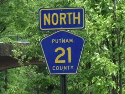
Putnam CR 21 |
2.14 miles
(3.45 km) |
|
 |
Mill St. |
Putnam CR 21 |
Westchester County Line
(Mill St.) |
1.32 miles
(2.13 km) |
|
 |
Wood St. |
Westchester County Line
(Wood St.) |
Putnam CR 30 |
1.80 miles
(2.90 km) |
|
 |
Secor Rd. |
 |
 |
1.86 miles
(2.99 km) |
|
 |
Hill St.
Long Pond Rd.
Crane Rd. |
|
 |
5.50 miles
(8.86 km) |
|
 |
West Lake Blvd.
North Lake Blvd. |
|
Putnam CR 72 |
2.97 miles
(4.78 km) |
|
 |
Croton Falls Rd. |
Putnam CR 72 |
Westchester County Line
(Westchester CR 136) |
4.02 miles
(6.47 km) |
|
 |
Stoneleigh Ave. |
Westchester County Line
(Westchester CR 137) |
|
4.37 miles
(7.04 km) |
|
 |
Drewville Rd. |
|
|
5.02 miles
(8.08 km) |
|
 |
Baldwin Place Rd. |
|
|
2.16 miles
(3.48 km) |
|
 |
West Shore Dr. |
Putnam CR 34 |
Putnam CR 36 |
2.00 miles
(3.22 km) |
|
 |
Gipsy Trail Rd. |
|
Friend Ln./Pioneer Rd. |
2.92 miles
(4.70 km) |
|
 |
Farmers Mills Rd. |
|
 |
5.96 miles
(9.60 km) |
|
 |
Ludingtonville Rd. |
 |
|
3.46 miles
(5.57 km) |
|
 |
Hill and Dale Rd. |
Putnam CR 60 |
Putnam CR 45 |
1.02 miles
(1.64 km) |
|
 |
Towners Rd. |
|
Putnam CR 60 |
1.59 miles
(2.56 km) |
|
 |
Terry Hill Rd. |
Putnam CR 60 |
|
0.87 miles
(1.40 km) |
|
 |
Old Route 301 |
Putnam CR 21 |
|
0.20 miles
(0.32 km) |
|
 |
Horsepound Rd. |
|
Nichols St. |
0.67 miles
(1.08 km) |
|
 |
Noonan Dr. |
Putnam CR 45 |
Putnam CR 60 |
0.35 miles
(0.56 km) |
|
 |
Sodom Rd. |
 |
Dead End at I-684/NY 22 ROW |
0.47 miles
(0.76 km) |
Former NY 22 alignment |
 |
Turk Hill Rd.
Morningthorp Ave. |
Putnam CR 55 |
Putnam CR 56 |
1.76 miles
(2.83 km) |
|
 |
Peaceable Hill Rd. |
|
Brewster Village Line
(N. Main St.) |
1.05 miles
(1.69 km) |
|
 |
Milltown Rd. |
|
Connecticut State Line
(Milltown Rd.) |
3.56 miles
(5.73 km) |
|
 |
North Salem Rd.
Deans Corner Rd. |
Weschester County Line
(Westchester CR 310) |
|
2.38 miles
(3.83 km) |
Former northern extension of  |
 |
Railroad Ave. |

|
|
0.39 miles
(0.63 km) |
|
 |
John Simpson Rd. |
|
Putnam CR 60 |
1.32 miles
(2.13 km) |
|
 |
N. Main St.
Tonetta Lake Rd.
N. Brewster Rd. |
Brewster Village Line
(N. Main St.) |
 |
2.85 miles
(4.59 km) |
|
 |
Crosby Ave. |
Putnam CR 58 |
Putnam CR 53 |
0.48 miles
(0.77 km) |
|
 |
Fair St. |
|
|
4.69 miles
(7.55 km) |
|
 |
Old Doansburg Ln.
Gage Rd. |
Dead End at Croton River |
Putnam CR 65 |
0.87 miles
(1.40 km) |
|
 |
Farm to Market Rd. |
|
 |
3.10 miles
(4.99 km) |
|
 |
Harmony Rd. |
 |
Dutchess County Line
(Dutchess CR 69) |
0.74 miles
(1.19 km) |
|
 |
Cornwall Hill Rd. |
|
|
2.36 miles
(3.80 km) |
|
 |
Doansburg Rd.
East Branch Rd. |
|
Putnam CR 68 |
4.45 miles
(7.16 km) |
|
 |
Fairfield Dr. |
Putnam CR 65 |
Connecticut State Line
(Fairfield Rd.) |
1.12 miles
(1.80 km) |
|
 |
Haviland Dr. |
Putnam CR 66 |
Irby Rd. |
1.54 miles
(2.48 km) |
|
 |
Haviland Hollow Rd. |
|
Connecticut State Line
(Haviland Hollow Rd.) |
2.50 miles
(4.03 km) |
|
 |
Stebbins Rd. |
Putnam CR 34 |
Putnam CR 38 |
0.93 miles
(1.50 km) |
|
 |
Myrtle Ave. |
Putnam CR 37 |
|
1.08 miles
(1.74 km) |
|
 |
East Lake Blvd. |
|
|
1.50 miles
(2.42 km) |
|
 |
Frances Kiernan Dr. |
|
Dead End at Northwood Inn |
0.12 miles
(0.19 km) |
Former US 6 alignment |