 |
New York 356 |
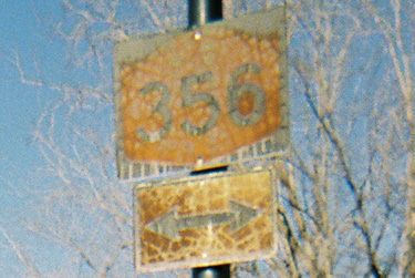
Old NY 356 directional signage on Colvin Blvd. north |
| Decommissioned: | 01/07/1988 |
| Western Terminus: | NY 265 / NY 266, Tonawanda |
| Eastern Terminus: | NY 270, Getzville |
| Length: | 6.49 miles (10.45 km) |
| Orientation: | East-West |
| Counties: | Erie |
| Cities: | Tonawanda |
| Villages: | None |
| Towns: | Amherst, Tonawanda |
| Name(s): | Young St., Ellicott Creek Rd., Sweet Home Rd., Dodge Rd. |
| History: |
NY 356's original western terminus was at NY 265/NY 266 in North Tonawanda. The western end would be truncated to US 62 in 1980. |
| Replaced By: | Erie CR 580, Erie CR 301, Erie CR 45 |
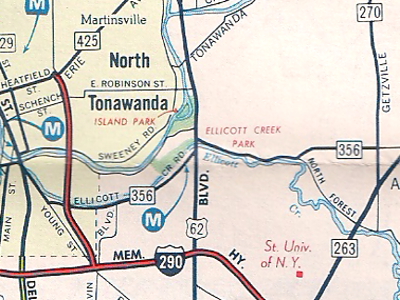
1975 Marine Midland General Drafting New York map
showing the NY 356 alignment.
|
No photos have been submitted.
If you have photos to submit, please contact us. |
|
Alps Roads (Steve Alpert) Wikipedia: New York 356 |

|
 |

|

|
Page Created: February 2, 2006 | Page Updated: August 23, 2020