 |
United States 104 |

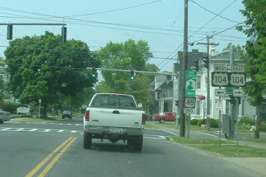
US 104 shield posted on 2nd St. in Niagara Falls. |

US 104 signage on W. 5th St. in Oswego. |
About |
Photos/Videos |
Links |
| Decommissioned: | 1972 |
| Western Terminus: | NY 384, Niagara Falls |
| Eastern Terminus: | US 11, Maple View |
| Length: | 171.38 miles (275.92 km) |
| Orientation: | East-West |
| Counties: | Niagara, Orleans, Monroe, Wayne, Cayuga, Oswego |
| Cities: | Niagara Falls, Lockport, Rochester, Oswego |
| Villages: | Webster, Sodus, Wolcott, Red Creek, Hannibal, Mexico |
| Towns: |
Lewiston, Cambria, Lockport, Newfane, Hartland, Ridgeway, Gaines, Murray, Clarkson, Parma, Greece, Irondequoit, Penfield, Webster, Ontario, Williamson, Sodus, Huron, Butler, Wolcott, Victory, Sterling, Hannibal, Oswego, Scriba, New Haven, Mexico |
| Name(s): |
Main St., Lewiston Rd., Ridge Rd., Lake Ave., Keeler St. Expressway, Rochester St., Cayuga St., Oswego St., Seneca St., Bridge St. |
| History: |
For the most part, US 104 followed its original alignment. However, safety improvements were made to sections of the highway between Rochester and Oswego. In the late 1960s and early 1970s, US 104 was moved from Ridge Rd. to the Keeler St. Expressway and a Super-2 was built in Wayne and Cayuga Counties (Part of the Wayne County Super-2 was widened to four lanes starting in 1991 and currently extends to just east of Williamson). In 1972, US 104 was reassigned as NY 104. |
| Replaced By: |
NY 104, NY 404 (Rochester-Webster), Wayne CR 103 (Ontario-Sodus), Wayne CR 143 (Sodus-Wolcott), Wayne CR 163 (Wolcott-Red Creek), NY 370 (Red Creek), NY 104A (Red Creek), Cayuga CR 127 |

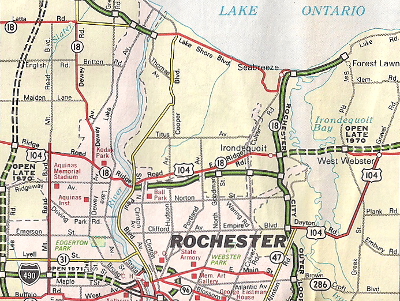
Scan from the 1970 Getty R.R. Donnelly New York map
showing US 104's alignment through Rochester prior to
being moved to the expressway alignment east of the city.
About |
Photos/Videos |
Links |
|
No photos have been submitted.
If you have photos to submit, please contact us. |
About |
Photos/Videos |
Links |
| Wikipedia: United States 104 |

|
 |

|

|
Page Created: August 20, 2006 | Page Updated: September 2, 2020